Climate change— Maps illustrating the relationship between pressures from human activities and the environmental states
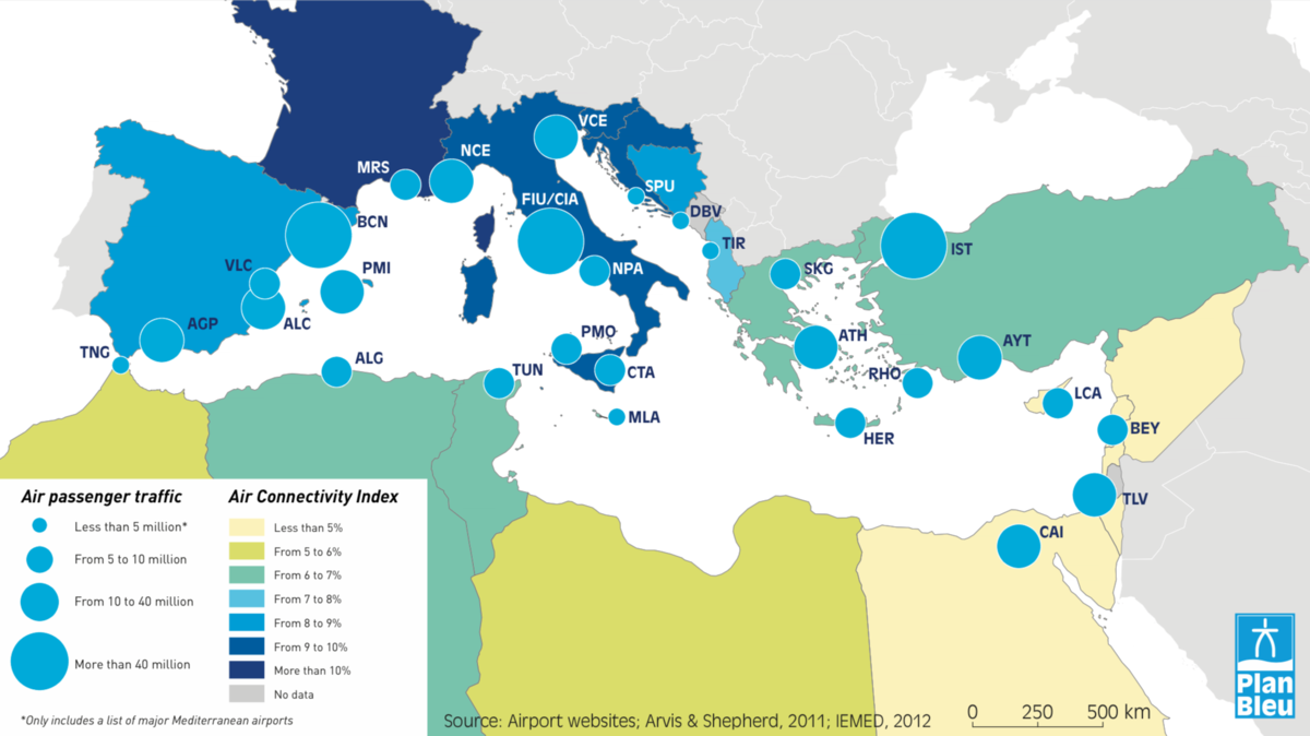
Air Passenger Traffic in the Mediterranean Coast, 2017, and the national Air Connectivity Index, 2012
The map shows the striking difference between NMCs and SEMCs in terms of air passenger traffic and connectivity by key coastal airports in the Mediterranean Region. NMCs rely on an extensive network of international airports, compared to SEMCs…
The Connectivity Index (Arvis & Shepherd, 2011) shows that NMCs are better connected than SEMCs. The Western Mediterranean region is the most connected, followed by the Adriatic-Ionian region. Algeria, Tunisia and Turkey have the best-connected airports among SEMCs.
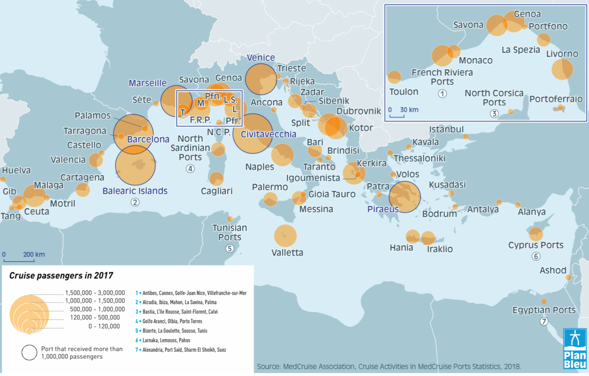
Cruise passengers per cruise call in the Mediterranean, 2017
The Mediterranean region has seen a significant and rapid rise in cruise ship movements over the past two decades: the number of individual cruise passengers in 2017 was almost 26 million, more than double compared to 2006, with 12 million cruise passengers (MedCruise Association, 2018)…
Today, the region stands as the second biggest cruising region in the world (15.8% of global cruise fleet deployment in 2017 (MedCruise Association, 2018)), after the Caribbean. Because of this continuous growth, ports are facing the challenge of providing proper infrastructure to accommodate large cruise ships and upgraded facilities to be able to accommodate an ever-growing number of cruise passengers as well as to collect and dispose of related waste. Ports accommodating more than 120,000 cruise passengers each year are considered major ports. 36 ports in the Mediterranean fall under this category, 25 of which are located in the Western Mediterranean area, 7 ports in the Adriatic and 4 ports in the Eastern Mediterranean area. Ports with fewer than 120,000 cruise passengers in 2017 include 15 Western Mediterranean ports, 11 Eastern Mediterranean ports and 6 ports located in the Adriatic (MedCruise Association, 2018).
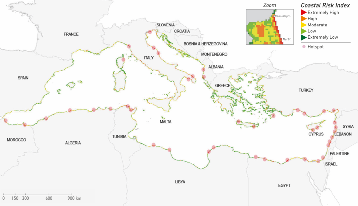
Regional risk assessment map for the Mediterranean based on the CRI-Med method
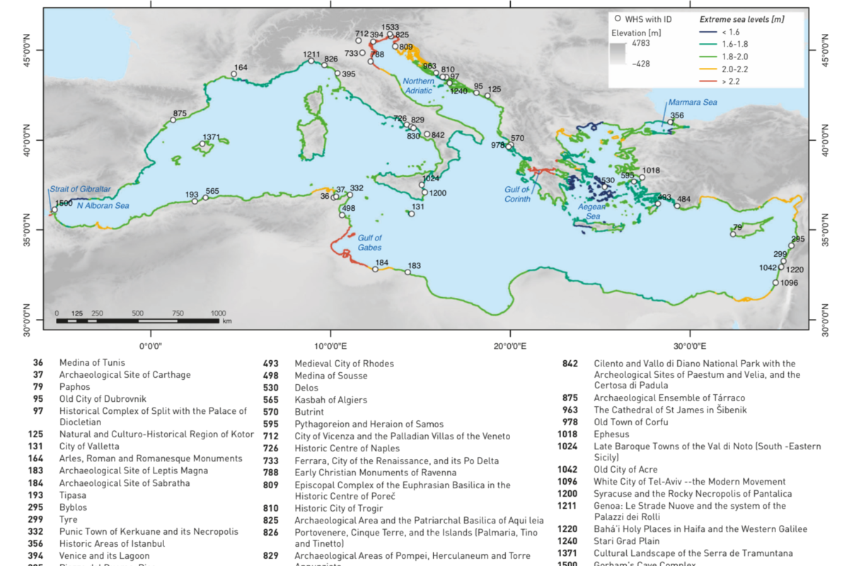
Risks related to climate change impacts are among the current most important coastal. The map shows a regional risk assessment map for the Mediterranean developed using the Coastal Risk Index (CRI)-Med method…
This integrated method was developed in 2015 and implemented to assess risk and vulnerability to the physical and socioeconomic impacts of climate variability and change in the Mediterranean with the aim of identifying coastal hot-spots (Satta et al. 2015). The map shows the Mediterranean coastal hotspots based on the aggregation of 19 variables (representing climatic and non-climatic forcing) and 3 sub-indices (hazard, vulnerability and risk). A coastal hazard zone is first defined according to the Article 8 of the ICZM protocol, then the 19 variables are calculated and weighted.
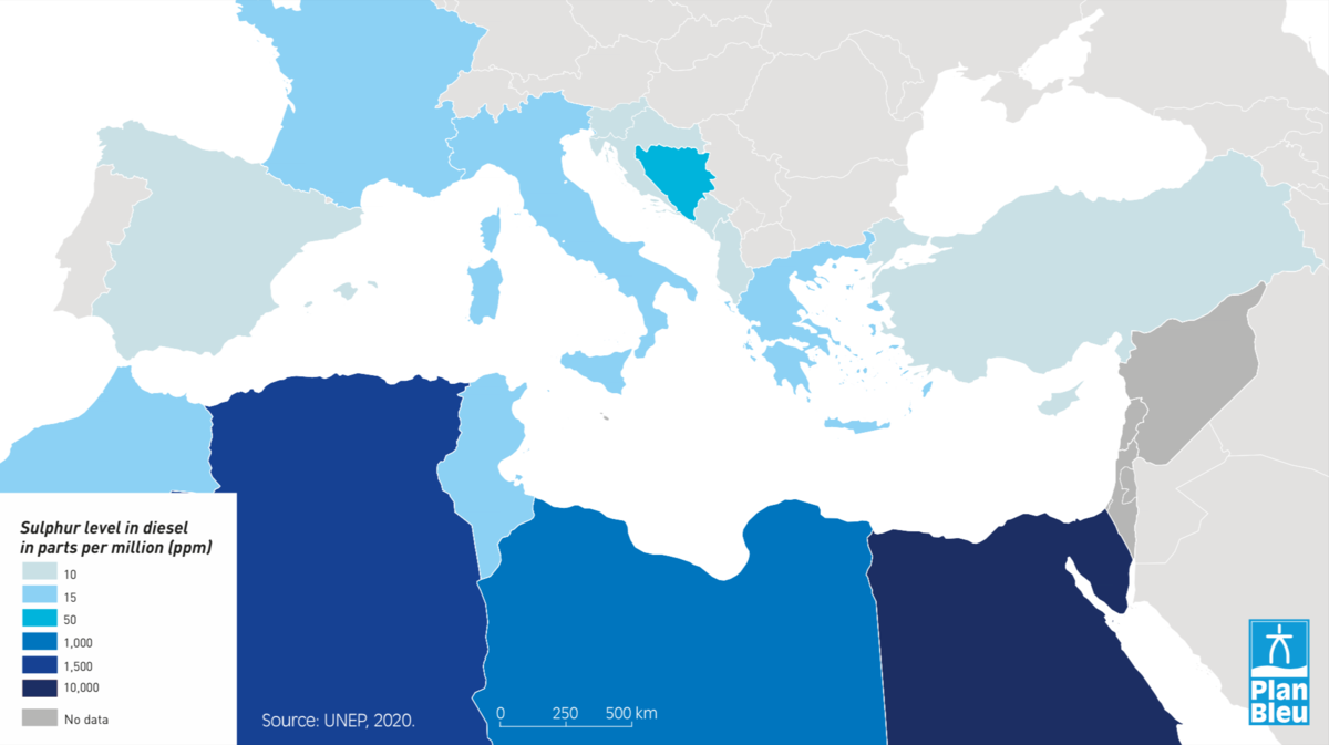
Diesel Fuel Sulphur levels in the Mediterranean, March 2020
Fuel quality is a key lever for improving air quality and human health. A 2019 United Nations Economic Commission for Europe (UNECE) recommendation consists of worldwide vehicle emission standards that cap sulphur levels in both gasoline and diesel at 10 ppm (equivalent to Euro 5 and Euro 6 and in line with the EU Fuel Quality Directive), applicable to cars and trucks…
Reducing sulphur to minimum levels will not only ensure optimal and reliable operation of emission controls systems in vehicles, it will also improve air quality, benefiting the environment and human health. Sulphur dioxide (SO2) adversely impacts human health, causing skin irritation and inflammation as well as irritation of the respiratory system. In the Mediterranean, almost all NMCs as well as Morocco and Turkey have already set sulphur level standards below 15 ppm. Many other SEMCs still have sulphur limits well above the recommended level for diesel and gasoline.

